
Variation 2 – Coastal Hazards
The Hearing for Variation 2 was held 17–20 March 2025.
All submissions can be found at Submissions on Variation 2 – Te Tai o Poutini Plan | West Coast District Plan
All further submissions can be found at Further submissions on Variation 2 – Te Tai o Poutini Plan | West Coast District Plan
What is proposed?
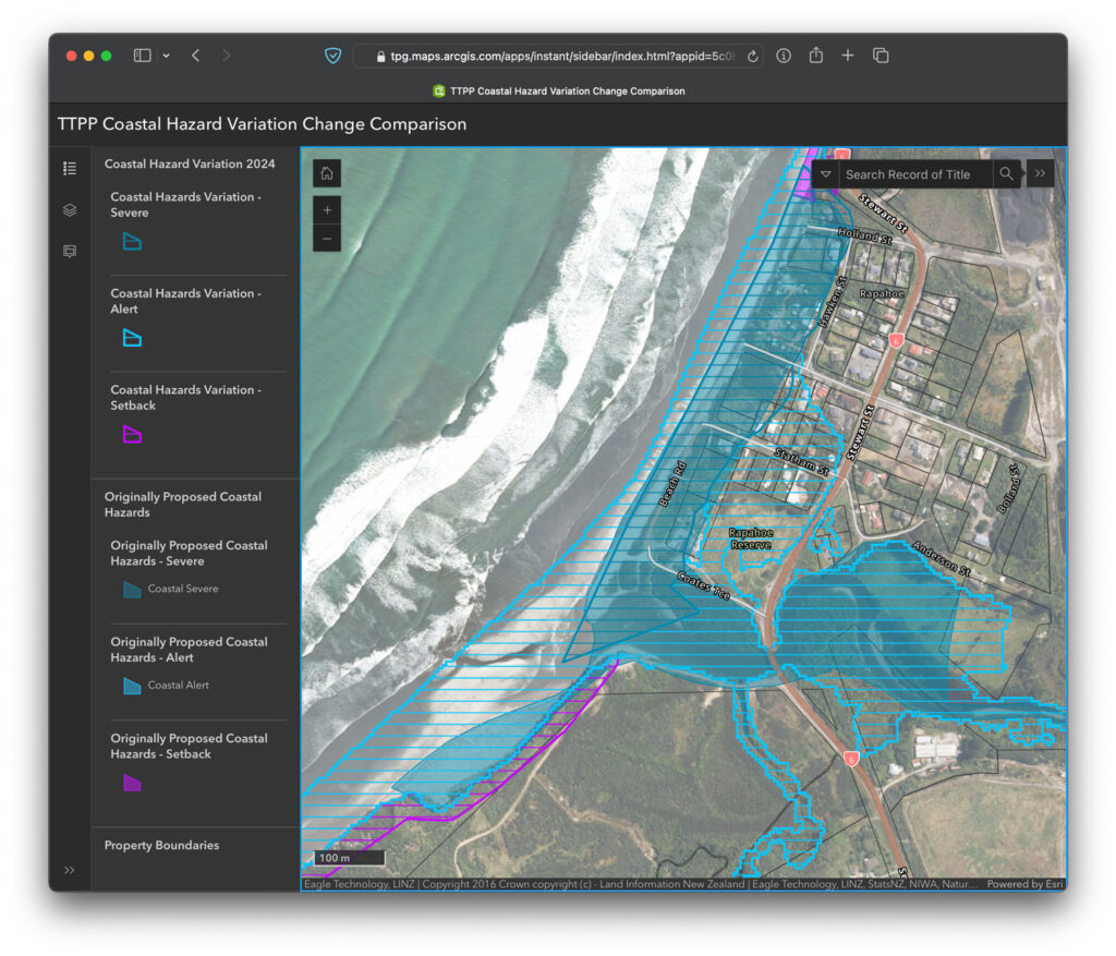
Coastal hazards (coastal erosion and inundation) in the proposed TTPP were mapped using the most accurate data and modelling available at the time. High accuracy LiDAR data was available for the Hokitika and Westport township areas as it had already been carried out for the planning of coastal and river protection works for those towns. The rest of the coast was mapped using lower accuracy space shuttle data.
More recently, improved LIDAR data like that used in Hokitika and Westport has become available for the remainder of the coast excluding the area north of Hector and south of Jackson Bay. This has meant the modelling work has been able to be updated to more accurately show the risks from coastal hazards. The TTPP Committee proposed a Variation to the Plan to update the mapping accordingly and to allow for submissions on the notified version of the objectives, policies and rules relating to this mapping.
The coast from the northern bank of the Taramakau River to Cobden (including Greymouth), from Hector north to Kahurangi Point, and south of Jackson Bay are not included in this variation to the Plan as updated data and modelling for those areas is still being developed.
How does this impact me?
The new mapping updates three of the hazard overlays which determine the rules that
would apply:
- Coastal Hazard Severe
- Coastal Hazard Alert
- Coastal Hazard Setback
These hazard overlays were included as part of the proposed TTPP, but the new mapping
Variation updates these in many places.
The impact of the new mapping varies in different areas. It shows increased coastal hazard
risk for some properties and reduced risk for others. Some properties may have larger or
smaller areas of the hazard overlays on them, for other properties there might be a change
from one type of hazard overlay to another, or a combination of these things.
The level of coastal hazard risk on a property influences the activities that can be
undertaken there.
How to find out more
View the changes for yourself online
The map viewer will allow you to view the original overlays plus the Variation 2 updates.
Questions
All queries regarding this proposed variation or the TTPP in general can be addressed to the TTPP Team at info@ttpp.nz, 03 768 0466, or 0508 800 118.
For more information about this variation and an evaluation of the proposed changes, please read the report prepared in accordance with section 32 of the Resource Management Act 1991, and the report below: